I biked 21.6 miles today on my Trek Checkpoint ALR 5 bike.
Download the GPX file for this ride
✨ About this Ride
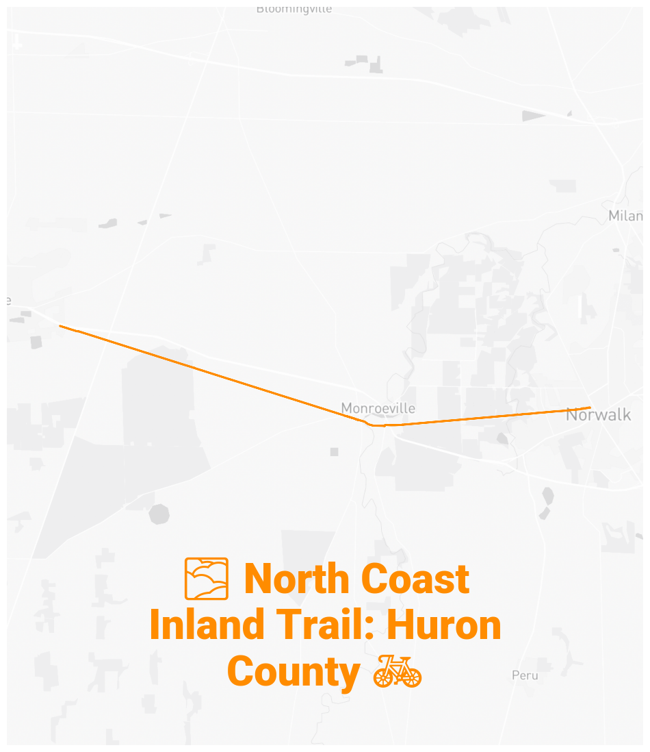
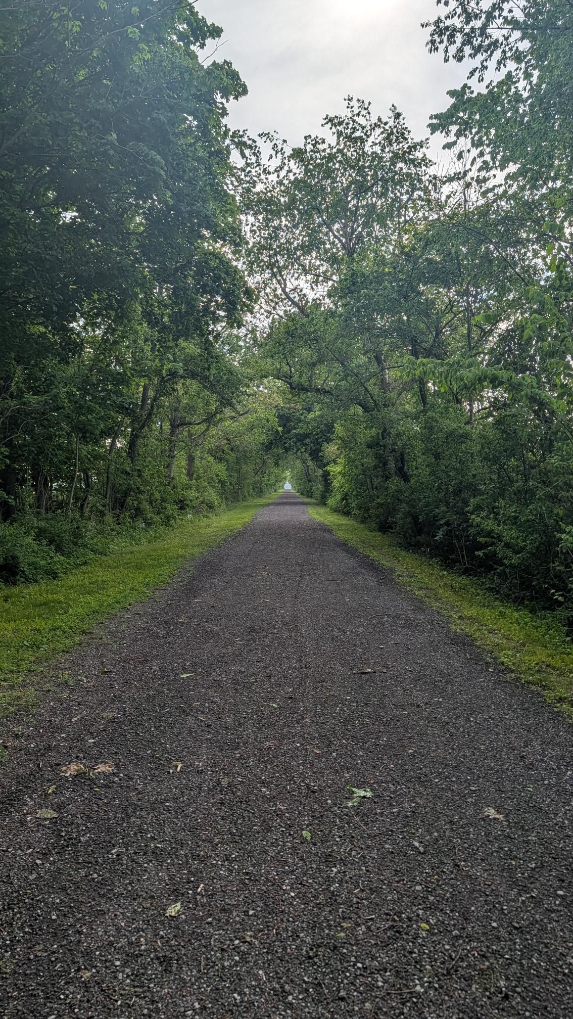
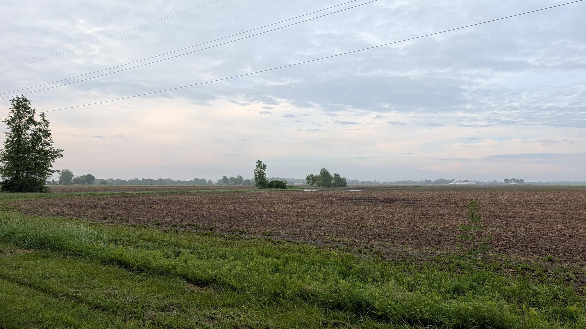
Today was my first ride on the Huron County portion of the North Coast Inland Trail and it was a highlight of my week. I recommend taking a ride along this trail if you ever get the opportunity. This rail trail is flat and impressively straight. When the path is not tree-lined, the views of Ohio farmland seem unending. The view of the Huron River from the Norwalk Kiwanis Overlook is the gem of the trail: stop and take a look.
🗺️ The Route
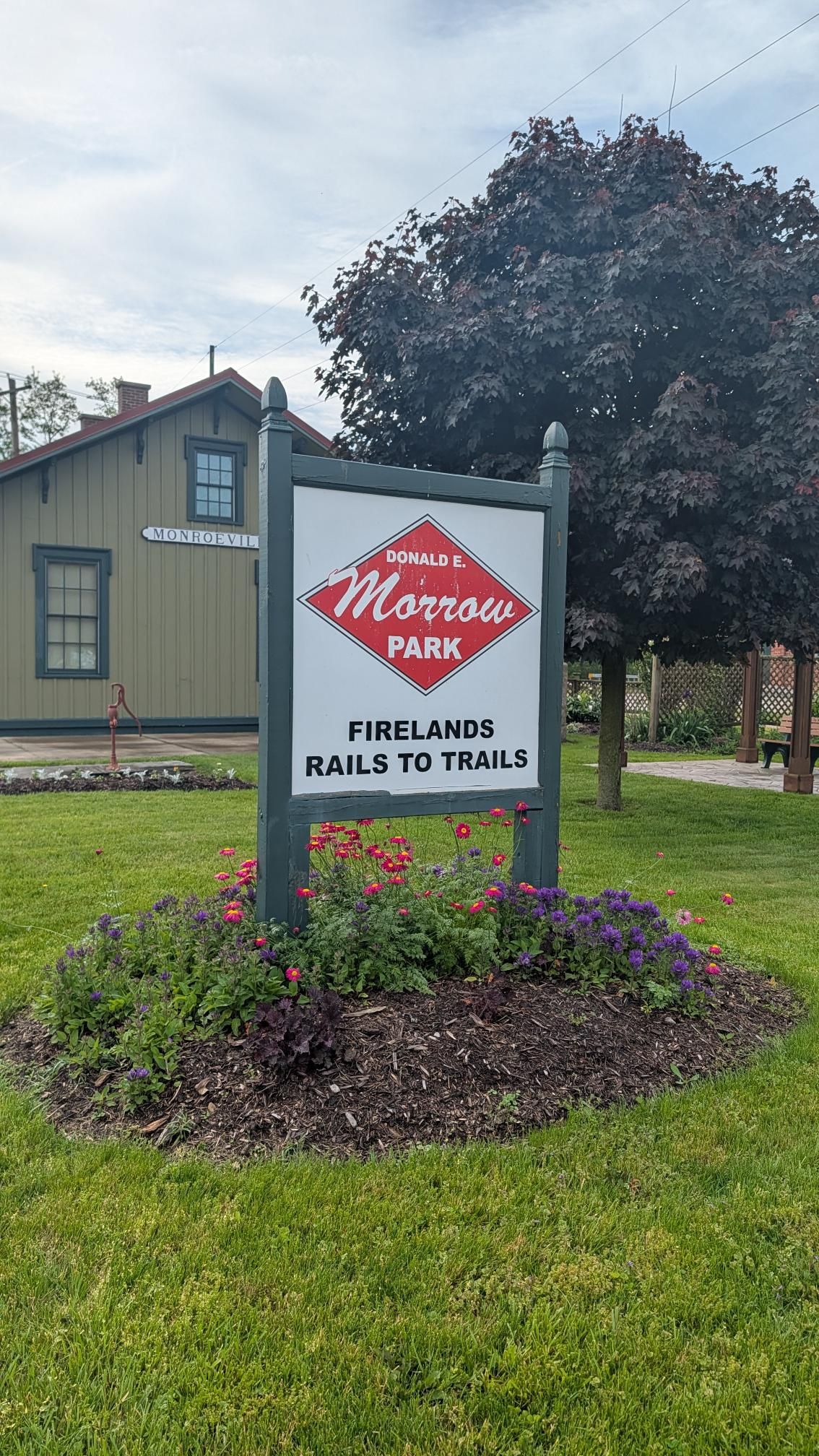
I began my ride at the Donald E. Morrow Depot & Park trailhead and rode West until I turned around in Bellevue, Ohio. I then rode East for about ten miles until I reached Norwalk, Ohio. As the trail entered town, it became a dedicated bike lane. That’s where I turned around for the return to Monroeville, where I started.
Take a look at the map above to see just how straight this trail is!
🤝 Share the trail
For the first ninety minutes of my ride, I didn’t see anyone on foot, on bike or in a train. Near Norwalk, the trail was populated, albeit sparsely.
🚂 Train: spotted!
For the vast majority of the time, my path paralleled an active rail line. In the final fifteen minutes of my ride, I saw a train heading West as it crossed over Main Street in Monroeville, Ohio.
🌾 The Terrain
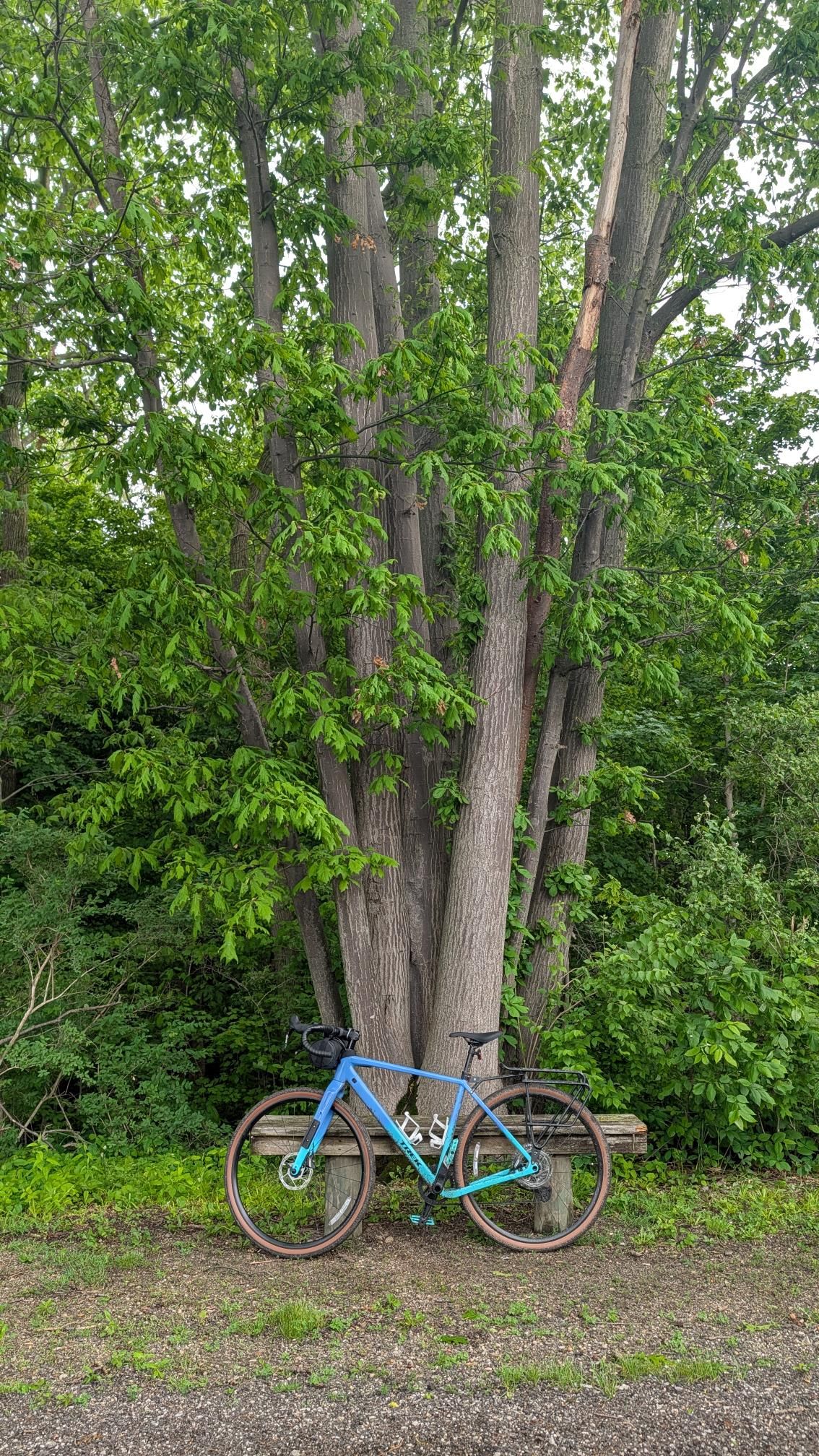
The terrain is typical for rail trails though in some sections there’s grass growing in the middle of the trail. The section I rode was a mix of grass, gravel, dirt and a small number of brief sections of pavement. The rain the day before left quite a few puddles along the trail that were big enough and frquent enough to completely avoid.
There are a few road crossings along the trail. Many of them carry riders across unmarked narrow county lanes. Given the landscape, you can often see any potential traffic coming from rather far away.
🚱 Amenities
There were no water fountains on the portion of the trail that I rode and I didn’t see any restrooms either. The towns of Monroeville and Norwalk have business districts accessible from the trail.
There were a few benches scattered along the trail. The trailhead that I departed from had a bike repair stand. The spot near where I turned around had a covered wooden bench.
🖼️ Photos


You can view the ride on fitness.by.brie.dev or on Strava (if we’re friends).
🤖 Parsed from Strava Data
The content in this section is automatically generated based on data sent to Strava.
💬 Description
No songs found.
🧪 Weather Impact: High humidity and fog reduced comfort; overcast skies increased effort and perceived exertion.
☁️ 100% | 🌡️ 58°F - 64°F | 💨 45 🎷🐛 10.6 new miles
— From Wandrer
📊 Stats and Route Info
- 👍 Kudos | 💬 Comments
- ⏱️ Moving Time: 02:07:49
- 📏 Distance: 21.6 miles
- ⛰️ Elevation Gain: 223ft
- 📍 Start: 41.240956, -82.703857 (View on Map)
- 📍 End: 41.240984, -82.70385 (View on Map)
- 🔋 Average Speed: 10.1 mph
- 🚀 Max Speed: 20.0 mph
👑 Segment Efforts
-
Mvlle to Bellevue and Back: 01:08:21
-
Prairie Rd to Norwwalk: 00:29:37
-
North Coast Inland Trail - Gravel Part 1 East: 01:01:56
-
SR 4 to Monroeville: 00:23:35
-
Swift Eagle: 00:14:46